Home>>
Scientific surveys valuable in safeguarding ecology on "roof of the world"(Xinhua) 08:07, August 19, 2024
LHASA, Aug. 18 (Xinhua) -- China's ongoing second scientific expedition and research project on the Qinghai-Xizang Plateau has produced a series of high-standard original findings, providing scientific support for the ecological security of the plateau, according to the expedition's top researcher.
To date, the scientific research has yielded significant progress, including results of studies on the changes and impacts of the plateau's water and glacier resources, carbon sink functions and potential, ecosystems, and biodiversity changes, said Yao Tandong, an academician at the Chinese Academy of Sciences (CAS) and the leader of the scientific expedition, at a press conference held in Lhasa on Sunday.
The Qinghai-Xizang Plateau, known as the "roof of the world" and Asia's "water tower," is China's most crucial ecological security barrier and a strategic resource reserve, playing a vital role in water, ecological, climate and environmental security globally.
Since the scientific expedition was launched in August 2017, teams comprising more than 7,000 researchers have continuously conducted comprehensive surveys across 19 key areas.
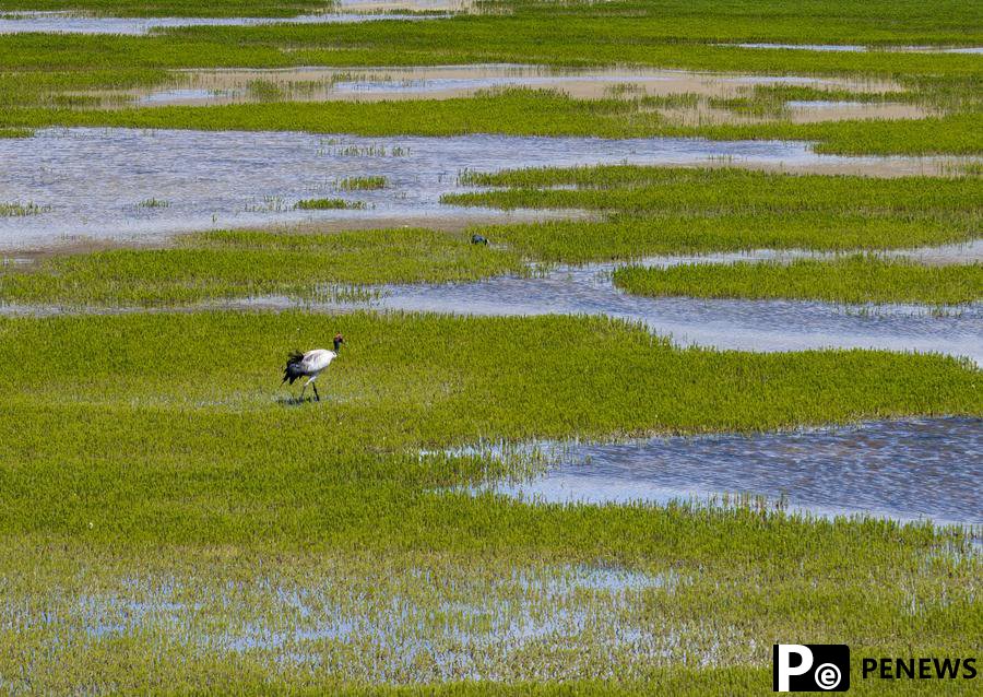
A drone photo taken on June 8, 2024 shows a black-necked crane searching for food at a wetland in Xainza County of Nagqu City, southwest China's Xizang Autonomous Region. (Xinhua/Jiang Fan)
CHANGES IN WATER RESOURCES
The Qinghai-Xizang Plateau is becoming warmer, wetter and greener, according to Yao.
"The glaciers and snow cover on the plateau are decreasing, while the vegetation is greening," he said. "Such changes could lead to significant shifts in the Asian monsoon circulation, potentially increasing the frequency of extreme weather events in China."
In recent years, the warming climate and increased humidity have led to significant imbalances on the Qinghai-Xizang Plateau, which have primarily manifested in the rapid reduction of solid water bodies such as glaciers and snow, alongside a widespread increase in liquid water bodies like lakes and rivers, resulting in a solid-liquid phase imbalance, Yao explained.
This scientific expedition and research project has revealed that the current total surface water storage of Asia's "water tower" exceeds 10 trillion cubic meters -- roughly equivalent to the total runoff of the Yellow River over 200 years.
Climate models predict that by the end of the 21st century, some regions could lose more than half of their glacier mass, with lake water levels potentially rising by over 10 meters, according to the conference.
While this phenomenon could enhance the overall water supply capacity, the risks of glacier collapses and glacial lake outburst floods are projected to be more than three times higher than current levels.
Yao also emphasized that the future water resources downstream of Asia's "water tower" require regionally differentiated strategies and comprehensive international coordination. "It is essential to strengthen the construction of early warning systems for glacial collapses and glacial lake outbursts, and to implement more effective measures for sustainable water resource management."
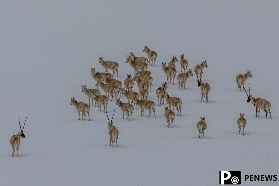
Tibetan antelopes are pictured on Qiangtang grassland, southwest China's Xizang Autonomous Region, May 8, 2024. (Xinhua/Jiang Fan)
ECOSYSTEM, BIODIVERSITY ASSESSMENT
The expedition team has established a classification system for the Qinghai-Xizang Plateau ecosystem based on the integration of remote-sensing technology and ground surveys, contributing greatly to the analysis of changes in the ecosystem and biodiversity of the plateau.
Researchers have completed a 1:500,000 grassland vegetation map, a 1:500,000 soil map of the plateau, and a distribution map of the alpine tree line spanning 2,400 kilometers across the Himalayas.
"These maps reveal the spatial pattern and dynamic changes of the ecosystem, and improve our assessment of ecosystem quality and its service functions," said Ouyang Zhiyun, a researcher at the Research Center for Eco-Environmental Sciences under CAS.
The maps also support the formulation of biodiversity conservation strategies and the overall layout planning for national parks on the Qinghai-Xizang Plateau.
The expedition team has also conducted extensive field investigations in vulnerable and critical areas on the plateau, leading to a series of new discoveries in biodiversity. It has published its findings of over 3,000 new species, including 205 new animal species, 388 new plant species and 2,593 new microbial species.
The local government in southwest China's Xizang Autonomous Region has designated over 600,000 square kilometers of its land as ecological conservation red lines, accounting for more than 50 percent of the region's total land area.